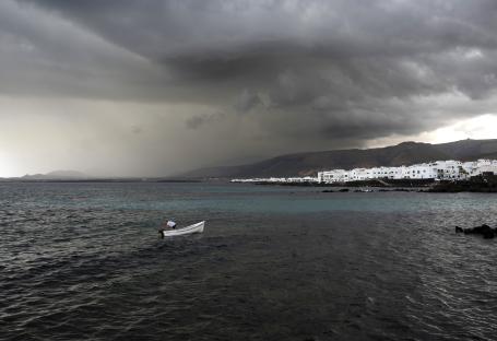
A MYSTERY island has seemingly vanished without a trace – sparking theories ranging from rising sea levels to government cover ups.
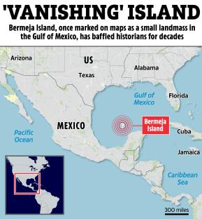
Bermeja Island, once marked on maps as a small landmass in the Gulf of Mexico, has baffled researchers and historians for decades.
It appeared on nautical charts for centuries – but it's now nowhere found.
So, did it sink, was it never there to begin with, or was it deliberately erased?
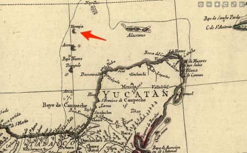
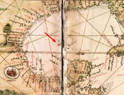
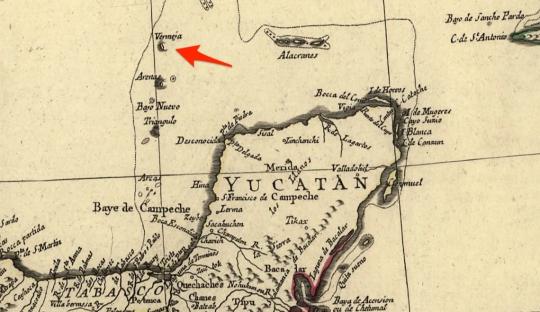
Bermeja first appeared in Spanish maps as early as the 16th century.
The name itself – derived from “bermejo”, meaning “reddish” in Spanish – suggested it had distinct features.
It was plotted in the Yucatán Channel, about 100 miles off the coast of the Yucatán Peninsula.
For centuries, explorers and mapmakers included it in official records.
But by the late 20th century, Bermeja started to fade from maps.
Jesús Israel Baxin MartÃnez, a geographer from the National Autonomous University of Mexico (UNAM), told Flying Eze that even in the 19th century, Bermeja appeared in official Mexican atlases.
He said: “Between the 16th and early 19th centuries, Bermeja Island was recorded on maps from various sources.
“In the 1858 Mexican Atlas, Bermeja Island clearly appears north of Cayo Arenas... but a year later, in the 1886 General Map of the United Mexican States, the island no longer appears.
“It is likely that the cartographer made some revision... but these [islands] had not been corroborated.”;
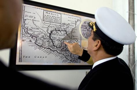
When the Mexican government sent a research team in 1977 to find it, they returned empty-handed.
In 2009, another expedition using modern satellite and sonar technology confirmed the same – Bermeja was simply gone.
There are several theories about Bermeja's disappearance – some scientific, others bordering on conspiracy.
A cartographic error
Some researchers suggest Bermeja Island may have never existed, attributing its appearance on maps to cartographic errors.
“It’s quite possible,”; MartÃnez said.
“Cartographers between the 16th and 19th centuries frequently copied geographical features from different maps without field verification.”;
Bermeja may have simply been the product of repeated cartographic copying, possibly confused with other Gulf islands like “El Negrillo”; or “Zarca”; that also vanished from maps over time, the expert added.
A 2009 study by UNAM found no evidence of the island’s existence, leading to the conclusion that it was likely a perpetuated mapping mistake, NBC reported.
Sunken island
Another theory is that if Bermeja did exist, it might have been a low-lying atoll or sandbank that was eroded by ocean currents over centuries.
But MartÃnez calls that unlikely, saying: “These causes are implausible; it seems impossible that sudden events could have gone unrecorded and left no trace over the past five centuries.”
Even though some historical sailing records suggest Bermeja had groves – indicating it was more than just a sandbank – no detailed cartography of the island was ever made.
“It only appears on maps of national scale or those of the Yucatán region,” MartÃnez added.
“If major erosion or a rise in sea level submerged any of the islands, traces would remain.”
Erased on purpose
A more controversial theory claims Bermeja was destroyed — or even erased from records — due to its strategic location.
The island would have extended Mexico’s Exclusive Economic Zone (EEZ), giving the country rights to valuable oil reserves in the Gulf.
Some believe it was secretly bombed, sunk, or removed from maps to shift maritime boundaries – possibly benefiting the US.
But MartÃnez was quick to argue against that theory.
He previously told Mexico News Daily: “It’s a conspiracy theory, of course.
“Isla Bermeja was a controversy because it was a key area of the Exclusive Economic Zone in the Gulf of Mexico.
“There were official searches around this time to see if there was some remnant of this island because the expansion of this zone for Mexico would mean an abundance of oil.”;
Despite extensive searches, no trace of Bermeja has ever been found, and its mystery remains unsolved.
MartÃnez concluded: “In short, the most plausible theory... is that it is a cartographic error replicated and unverified over more than 400 years.”;
But he also warns that Mexico’s focus on lost islands like Bermeja overshadows a bigger issue: the neglect of the country’s real, inhabited islands.
“Mexico has neglected its island territory and has focused efforts on investigating lost or apparently fictitious cases... rather than defending the real islands over which the country has sovereignty.”;
Whether it was a mistake, a victim of climate change, or something more sinister, one thing is certain — the island has left a ghostly imprint on history.