THE Met Office has warned the Easter break could be a washout with heavy showers set to hit the country in just hours.
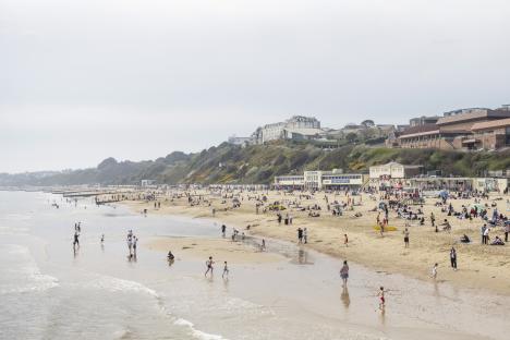
Saturday was the UK's warmest day of the year so far with 24°C recorded in Northolt, North West .
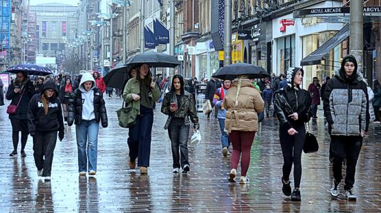
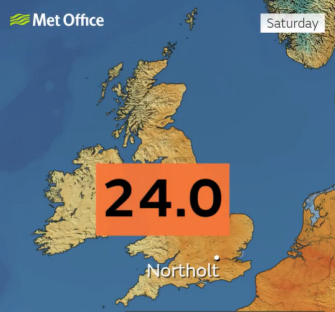
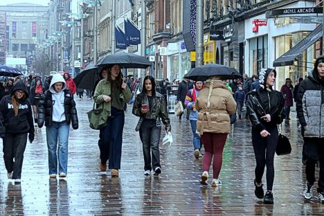
But it also saw rain returning to some for the first time in a fortnight.
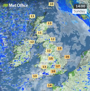
Sunday will see a mix of bright spells and showers with some turning heavy especially towards lunchtime.
The most frequent showers are expected across and Northern Ireland.
It will feel fresher for many, but still warm across the southeast, the service added.
The forecaster said low pressure returned this weekend after a prolonged period of high pressure brought dry weather and sunny skies.
Chief Meteorologist Jason Kelly explained: “A change is on the way this weekend, as we say goodbye to the wall-to-wall sunshine.
“High pressure sinks southwards and allows low pressure to take hold bringing more cloud, rain and showers, and also lower temperatures.
“By Sunday, conditions will be fresher, with sunny spells and light to moderate winds.
“Showers will be most frequent in the west and northwest, where they could be heavy, bringing a risk of isolated thunderstorms and hail.
“Precipitation may be wintry over the highest ground, over 600 metres.
“Many eastern and southeastern areas are likely to stay dry and rather warm following clearance of early rain, whereas temperatures will be much cooler in the northwest of the UK.”
Low pressure is likely to lie in the vicinity of the UK into next week bringing a mixture of showers, longer spells of rain and some drier interludes.
The Met Office said it was carefully monitoring the period of Tuesday to Thursday.
There is a chance that an area of heavier rain moves up from the south, or southeast, which could also be accompanied by stronger winds.
Temperatures overall are most likely to be around average for the time of year with some chilly nights and locally warm days.