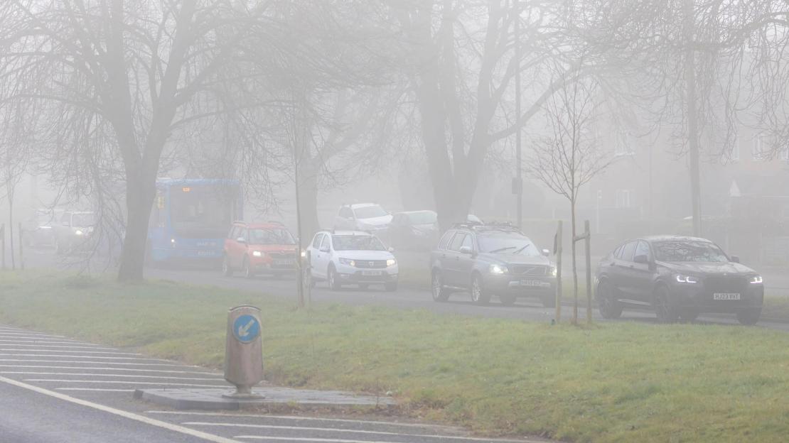
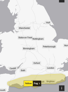
THE Met Office has issued a yellow weather warning for fog, with drivers facing difficult conditions.
The extreme weather is causing traffic chaos for commuters this morning in the south.
It comes after similar conditions put flights at risk of being cancelled yesterday.
The warning states: “Not everywhere will see fog, but where fog patches do occur, visibility may fall below 100 metres in places, leading to difficult driving conditions and some travel disruption.”
It is in place until 9am today across the south coast of England.
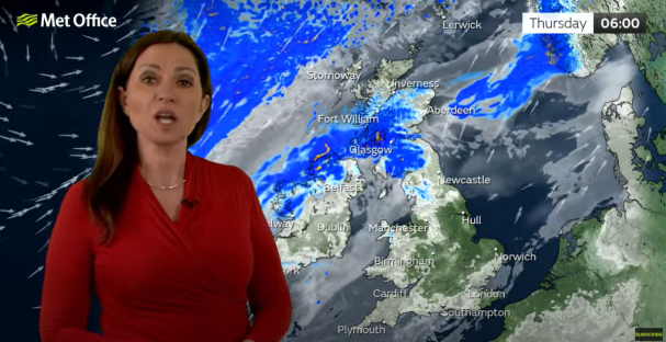
Met Office meteorologist Clare Nasir said it's a “chilly start” in southern England and Wales, adding: “Watch out for one or two mist and fog patches.”
In the North, there's cloud and drizzly rain, “so poor visibility over the higher ground”.
“This rain never pushes very far south, it's going to remain across central parts of Scotland,” said Ms Nasir.
Another weather front with “more momentum, more force on it” and “slightly stronger” winds, however, is set to sweep in from the west and “eventually this whole system will clear down towards the South”.
She went on to say: “Winds will be a feature of the weather over the next 24 hours.”
However, there will be some “fine” weather in parts of the country for much of the afternoon – though with some persistent rain continuing to move in during the evening.
Temperatures are due to peak at 17C in parts of the South East, including London, with much of the country in the mid to high teens.
But the chilly winds sweeping across the country will mean it feels colder going forward.
Ms Nasir said: “It is turning colder for many areas, temperatures around average, if not slightly below as we head through Friday and into Saturday.”
The Environment Agency has issued one flood warning and 16 alerts across England.
Five-day weather forecast
Today:
Breezy in the northwest as cloud and outbreaks of rain continue to slowly sink southeast, becoming heavy and persistent through the afternoon.
Ahead of this, mist and fog clearing to leave a dry day with some warm sunny spells.
Tonight:
Remaining windy in the northwest as rain continues southeast overnight, but tending to weaken in the south by dawn.
Blustery showers following behind with a risk of hail and thunder.
Friday:
Rain eventually clears southeast through Friday, with sunny spells and scattered showers following behind.
Feeling a little cooler than Thursday, with temperatures closer to average
Outlook for Saturday to Monday:
Further rain possible in the west on Saturday, but drier overall on Sunday and Monday.
Temperatures recovering to above average by early next week.