BRITS are set to flock to beaches today as temperatures soar to 23C – but rain may be on the way this weekend to ruin the good weather.
has said high pressure remains “in charge” of weather currently, helping to bring sunshine and above average temperatures across the UK.


While some areas could reach highs of 23C today, the forecaster has also warned that more “unsettled” conditions could be on the way this weekend as the high pressure system moves away.
Parts of eastern and northeast England are expected to have the best of the sunlight on Thursday – helping them reach higher temperatures than the 21C in , , today.
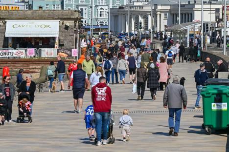
Beaches across and in parts of , such as St Andrews, are likely to be heaving as locals and visitors rush to the coast to lap up the good weather.
Met Office Chief Meteorologist Andy Page said: “Warm and dry weather continues for much of the UK this week, but we’ll see a shift in where the highest temperatures will be over the next few days.
“Those living along North Sea coasts, who have so far had generally lower temperatures and more cloud at times, will start to see the higher temperatures on Thursday, possibly reaching as high as 23°C in eastern Scotland and northeast .
“This is due to a shift in the dominant wind direction from the east to the west.”
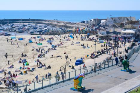
Just yesterday, countless visitors and residents were seen lounging on beaches across the UK as the warm conditions continued.
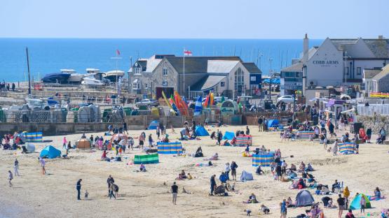
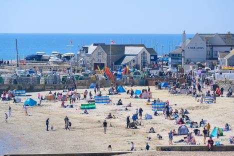
In Lyme Regis, , parasols could be seen dotted along the beach as families on their enjoyed the sunlight.
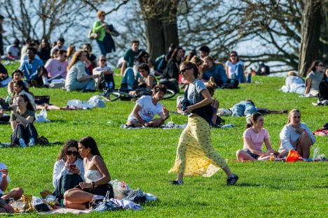
At the weekend, many were seen enjoying picnics in parks across while dogs were also spotted dipping into water to cool off in .
However, rain could be on the way for many this weekend, bringing an end to the unprecedented warm stint.
While most of us will have dry and fine conditions on Friday, the far northwest of Scotland is likely to see some rain and drizzle later on in the day, the Met Office said.
The weather agency added that this change would also start to take effect on a wider scale overnight into Saturday, despite more highs of potentially 23C in southern England and on Friday.
Met Office Deputy Chief Meteorologist Mark Sidaway explained: “The high pressure that has been responsible for our recent high temperatures gradually shifts away over the weekend, as more of an unsettled regime begins to take charge and introduces more frequent rain and cloud, as well as a drop in temperatures.
“Those in the far northwest will see the first of the rain late on Friday and into Saturday, and while Saturday will start dry for much of the UK, we are likely to see areas of showers moving in from the south later in the day, although this aspect is still quite uncertain.
“However, by Sunday fresher conditions with showers are expected to move in from the west.”;
The Met Office explained that low pressure areas are likely to lie west of the UK heading into next week, bringing “likely” showers and some longer spells of rain.
However, the weather agency said there could still be some drier and sunnier intervals, helping keep temperatures around average for this time of year.
On Saturday, Met Office weather maps suggest a long front of rain could hit across western, northwestern, and northern Scotland throughout Saturday.
By Sunday, there could also be some scattered showers across much of Wales as well as northwest England and southern Scotland.
, we will begin to see some “fresher conditions” in the lead up to.
A “cold front” progressing southeast could bring some “rain and showers”, the Met Office said.
In addition, there is “a low risk” of heavier, possiblythundery showerscoming into the country from the south for a time early in the period – however, this may well pass to the east.
What we can expect isApril showersto kick in about halfway through the month, leading to the development of strong winds in some areas, particularly in the south and west.
At this time, temperatures are likely to return closer to normal.
When April draws to a close,unsettled weathermay persist with showers or longer spells of rain in places.
However, high pressure conditions might return early May, bringing with them warmer temperatures.